|
|
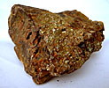
Copper
Lake Cu, Fe, Au Mine (Polsons Lake), Antigonish
County
|
UTM (NAD27)
Zone 20
|
Northing
5028375 |
| Easting
579915 |
|
Details:
|
Drive north from the village of Goshen for 3
km to Copper Lake. From an intersection at this point, drive northeast
along a road that follows the shore of the lake for another 0.8
km to a small bridge over a stream, which flows into the eastern
end of the lake. Walk southeast along a farm laneway across a farmers
field which begins about 30 m west of the bridge. The prospect is
located in the woods adjacent to the field 200 m southeast of the
road that follows the lake shore (Ervine, 1994) |
|
References:
|
NSMOD
#F05-003 |
|
Further
Info:
|
Copper was first noticed in the vicinity of
Copper Lake in the 1850's by a Cornishmen whose plans to proceed
with a mining operation were thwarted when he, and the ship in which
he was sailing to England in order to raise capital, were lost at
sea. In 1867 a company was formed to explore the area but operations
were suspended without finding a vein. Boulders carrying chalcopyrite
and pyrite and a gossan were the only indication of mineralization
up to that time. Dr. G. M. Dawson and Sir William Dawson visited
the area in 1872, found boulders running 10-13% Cu and predicted
a vein should be found nearby. As a result, an Alex McBain discovered
the Copper Lake vein in 1875 and formed a company. Another company
was also formed by an associate of Mr McBain's, a Mr. A. P. Ross.
In 1876 the two companies cooperated in a venture to sink 2 shafts
46 m apart. A feud errupted over property boundaries and operations
ceased as court actions proceeded. This situation continued for
20 years until the two companies went bankrupt. At that time the
deeper of the 2 shafts had only been sunk 18 m. In 1890 the Copper
Crown Company, and later the Lake Copper Mining Company Limited,
acquired and mined the property. The latter company developed a
total of 244 m of underground workings. In 1908 the main shaft was
41 m deep, with levels at 6, 11 and 30 m. In the years prior to
1908, a total of 325 tonnes of ore averaging about 5% Cu were produced
from the deposit. Nearly 100 tonnes of this ore averaging 11.6%
Cu were shipped in three lots to Swansea, Wales, Liverpool, England
and New Jersey, USA. Another lot of 136 tonnes averaging 3.5% Cu
was shipped to Pictou, N.S.. The remaining 91 tonnes of 2% Cu were
left on the dump. Between (1908-1910) further underground work consisted
of deepening the partly inclined main shaft as well as the air shaft,
sinking a new shaft and some crosscutting. It is reported that 1,090
tonnes of ore were on the dump by 1909. Work stopped in 1910 and
except for minor work in 1925-27. No record of any further work
is known until 1937 when the Mining and Finance Company of Halifax
partially dewatered and rehabilitated the workings and carried out
a sampling program under the supervision of a Donald F. MacDonald.
He reported that the main shaft was in ore to a slope depth of 46
m, where flooding prevented further search. He also reported an
air shaft 12 m deep was also in ore and a crosscut extended nearly
61 m into the hanging wall. Another shaft, near the lake, was full
of water and said to be 46 m deep, but had not yet reached the vein.
Except for some pits and trenches dug in 1948, no further work was
reported until 1951, when H. L. Cameron, who had worked on the property
in 1937, wrote a summary report concluding that the mine warranted
no further development work. However, he did recommend further exploration
should be carried out by geophysical methods and diamond drilling.
Cameron also reported that the main shaft stopped at a depth of
290 feet. Cameron reported again in 1952 for Northern Mineral Limited
that in 1951 the mine was completely dewatered and the lower levels
were sampled. Copper values were found to decrease with depth. Bulldozing
exposed the vein from the shaft to the schoolhouse, but the eastward
extension was not found. It was thought that northeast-trending
faults may have displaced the veins. Between 1962 and 1964 Novamine
Syndicate, under the direction of Mr. P. Lacombe, carried out magnetometer,
resistivity, and self potential surveys and a 24 hole diamond-drilling
program totalling 2,377 m. The drilling outlined two parallel sulphide
zones. One was 1.8 m thick and was traced for 275 m with the best
intersection returning 1.19% Cu, the second was 1.4 m thick and
was traced for 30 m with the best intersection returning 2.21% Cu,
each over their respective widths. The overall average was 1.38%
Cu. In 1969 the property was acquired by the Great Horn Mining Syndicate
Incorporated, who carried out geochemical and geophysical (EM, spontaneous
potential) surveys as well as follow-up diamond drilling. In 1972
the International Mine Services undertook a geochemical survey. |
|
Other
Minerals:
|
ankerite, bornite, chalcopyrite pyrite, siderite |
|
Dunbrack
Pb, Cu, Zn, Ag Mine, Halifax County
|
UTM (NAD27)
Zone 20
|
Northing
4962571 |
| Easting
484916 |
|
Details:
|
The Dunbrack Pb, Cu, Zn, Ag Mine (really only
a development prospect by modern mining standards) consists of two
shafts found a few kilometers north of the village of Musquodoboit
Harbour, Halifax County. |
|
References:
|
NSMOD
#D14-009 |
|
Further
Info:
|
extensive information & references available
in the Mineral Database |
|
Other
Minerals:
|
galena, tridymite,
tourmaline, fluorite,
azurite, pyrrhotite,
cerussite, ilmenite,
djurleite, digenite,
sphalerite, pyrite,
bornite, chalcocite
malachite, meneghinite,
pyromorphite |
|
Meat Cove
Zn Deposit, Inverness County
|
UTM (NAD27)
Zone 20
|
Northing
5208730 / 5208360 / 5208160 |
| Easting
682840 / 683150 / 683150 |
|
Details:
|
The Mine Road leads south from the Meat Cove-Lowland
Cove Road, approximately 3.2 km west of the village of Meat
Cove (200 m west of the juncture of the road with French Brook).
The Northwest Zone is exposed along a brook valley, a short
distance west of the Mine Road, approximately 600 m south of
the juncture of the Mine Road with the Meat Cove-Lowland Cove
Road. Coordinates 2: Adit Zone The adit is located along the
Mine Road, approximately 500 m southeast of the Northwest Zone.
It was driven on a steep east dipping slope, along the south
side of a tributary of French Brook. The discovery outcrop is
located along this tributary, approximately 70 m northeast of
the adit portal. Coordinates 3: South Trench Zone Two large
trenches are found on top of the hill, approximately 200-300
m south of the Adit Portal.
|
|
References:
|
NSMOD
#N02-002 |
|
Further
Info:
|
The Meat Cove Deposit is primarily a Zn deposit in which
sphalerite is the dominant sulphide mineral. The sphalerite
occurs as coarse grained massive crystalline aggregates, as
disseminations, as bands and as veins. Chatterjee (1979) reported
that sphalerite commonly replaces brucite, antigorite and pyrite.
He also noted that the most significant Zn-mineralization occurs
as a replacement of forsterite bearing units within the magnesian
alteration zone. Other minerals reported to occur within the
deposit include pyrite, pyrrhotite, chalcopyrite, galena, graphite,
fluorite, arsenopyrite, stannite, germanite and renierite. Pyrite,
which is the second most common sulphide mineral, occurs as
independent crystals and aggregate masses.
|
|
Other
Minerals:
|
sphalerite, fluorite,
arsenopyrite, marcasite,
stannite, braunite,
pyrite, pyrrhotite,
germanite, renierite,
galena, graphite |
|
M.e.x.
Uranium Showing, Hants County
|
UTM (NAD27)
Zone 20
|
Northing
4964040 |
| Easting
425770 |
|
Details:
|
The prospect is located in 2, side-by-side gravel pits
found along a lumber road, approximately 500 m north of Christie
Lake. Christie Lake is approximately 30 km northeast of Halifax
and is immediately west of Big Indian Lake.
|
|
References:
|
NSMOD
#D13-026 |
|
Further
Info:
|
The type and style of mineralization is similar to that
at the Millet Brook Uranium Deposit, Hants County, Nova Scotia.
Finely disseminated U-bearing phosphates (torbernite and autunite),
chalcopyrite and pyrite are associated with an extensively hematized
northeast-trending, shear zone. The uraniferous zone extends
for approximately 100 m along the shear.
Rock types exposed in the gravel pit encompass all phases of
the Big Indian Polyphase Intrusive Suite. The wall rocks exhibit
intense hydrothermal alteration, including high-alumina hydrothermal
alteration as reflected by the presence of andalusite, cordierite,
sillimanite, spinel, garnet, muscovite, biotite and tourmaline.
|
|
Other
Minerals:
|
autunite, pyrite,
torbernite, sillmanite,
andalusite |
|